
“Is there a cell tower near my house?”
It is one of the most common questions we hear.
Sometimes it comes from someone about to buy a home. Sometimes a new antenna has appeared on a rooftop down the street. Sometimes a person simply wants to know what is around them before deciding what, if anything, to do about it.
The answer is mostly public. In Canada, radio transmitters that need a licence are licensed by the federal government, and most of those licences are published. The difficulty has always been reading them.
So we built a free map that does it for you: the EMF Aware Canadian Tower Map.
Every source, one simple map
ISED keeps its licence records in several different databases: one for cell sites, one for broadcasting, one for everything from two-way radio to aviation and marine, and more.
We take them all and combine them into one simple map.
- Want to know where the nearest AM, FM or digital TV broadcast tower is? We have you covered.
- Want to know where the nearest cell tower is? It’s there.
- Want to know how far you are from an airport radar station, or a marine radar at the marina? That’s there too.
It is the most comprehensive EMF spectrum map of Canada, and it is simple to use. We check ISED for new records every day, so it stays current.
How to use the map
There are three ways to start a search:
- Type an address in the search box and pick it from the suggestions
- Tap the map at any point
- Use your location, if your browser allows it
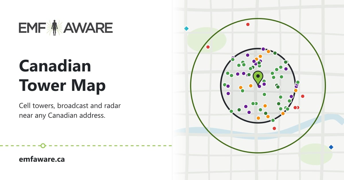
The map then draws rings around that point:
- 1 km for everyday sites: cellular, fixed wireless, two-way radio, aviation and others
- 2 km for AM, FM and TV broadcast towers
- 45 km for radar, drawn only when radar is found
Each coloured dot is a licensed site. Tap one to see who operates it and what is licensed there.
How to read the results
The first thing you see after a search is a short summary. Here is a real one, for a point in downtown Calgary:
- Nearest cell site: 67 m, Bell Mobility
- Nearest broadcast tower: 232 m, a SiriusXM satellite radio repeater
- Radar: 13 sites within 45 km, the closest 4.8 km away
- Closest site of any type: 4 m, a two-way radio licence
Below the summary is the full list, nearest first. Each card shows:
- The type of site, such as Cellular, Land Mobile or Broadcast Radio
- The operator, from the licence
- The distance from the point you searched
- How many transmitters are licensed there, how high they are (the tower for broadcast sites, the antennas for the rest), and on which frequencies
Open a card for the full licence details: power, the height of each antenna, which way it points and more.
What “source rating” means
Each card also carries a source rating: Likely High, Directional High, Moderate or Low/Unknown.
This is EMF Aware’s general rating for each type of transmitter, based on its licence type. A broadcast FM tower is a different kind of source from a two-way radio on a construction site, and the rating reflects that.
It is not a measurement at your address. Two sites with the same rating can produce very different levels in a home.
What licence data cannot tell you
This is the part most people skip, and it matters most.
A licence shows what a transmitter is allowed to do. It does not show what is reaching your bedroom.
What you are actually exposed to depends on things the records cannot capture:
- Which way the antennas point. Cell antennas are usually aimed in sectors, so a site 100 m away may point away from you, while one 300 m away points straight at you.
- Whether the antennas have a direct line of sight to your home. Hills, buildings and trees in between can block or weaken the signal; a clear view lets more of it through.
- How busy they are. Many transmitters change output through the day.
- Your building. Walls, windows, roofing and even the direction a room faces all change what gets in.
Records also have gaps. Some transmitters are not in ISED’s public data, such as federal radar and some government systems. Low-power equipment like Wi-Fi does not need a licence at all. And records can be incomplete, out of date or placed in the wrong spot.
So distance on a map is a starting point, not an answer.
When to get help
If the map shows a cell site close to your home, or you simply want to know rather than guess, we can help.
A Cell Tower RF Assessment measures the radio frequency levels in your home from nearby towers, maps them, and compares them against exposure guidelines.
Buying a home? A pre-purchase EMF inspection includes a cell tower map with a sweep of the property, so you know what you are buying before you sign.
Not in Calgary or Edmonton? We help remotely too. We provide remote support for people who are looking for a home or have questions about their exposure. We can even guide you through EMF measurements remotely, so you understand your environment and your options for reducing exposure.
Frequently asked questions
Is the map free?
Yes. There is no sign-up and nothing to install.
Does the map show 5G?
Yes. Canadian carriers run 5G today on lower frequency bands, such as 3500 MHz, from the same cell sites as 4G, so it appears on the map as Cellular. Open a site to see the technology on each licence.
The map also has its own colour for 5G millimetre wave (mmWave), the very high frequencies above 24 GHz, but you will see very little of it. Those bands have not been auctioned yet: ISED’s mmWave auction for the 26 and 38 GHz bands is scheduled to open on January 25, 2028. Until then, only a few legacy providers hold licences in these bands, mostly for fixed wireless links rather than phones.
Does it work outside Canada?
No. The data comes from ISED, so the map covers Canadian addresses only.
Why isn’t a tower I can see on the map?
It may not be in ISED’s public records, it may be newly built, or its record may be placed in a slightly different spot. Some structures that look like towers carry no licensed transmitters at all.
Can I share or save a search?
Yes. Copy share link gives you a link that reopens the same search. Export offers a plain-text report snippet with a QR code, or a CSV of every transmitter found.
Try it at emfaware.ca/tools/canada-emf-tower-map. If what you find raises a question, get in touch. We are happy to help you work out what it means for your home.